|

Queen
Anne Tower Weather Webcam from: KING5 TV
[CLICK
HERE: OVER 70 artists and bands from the
Pacific
Northwest are profiled on FadedFlannel.com ]
|
|

Seattle Waterfront Webcam
from: KING5 TV

|
|

NOAA Webcam - National
Weather Service, Seattle WA
|

Webcam: Amar
Andalkar's Ski Mountaineering and Climbing Site
|
|
East of Seattle,
Along I-90 to Snoqualmie Pass
(Snoqualmie
Pass is 52 Miles from Seattle)
|
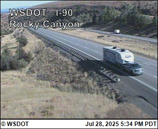
I-90
Floating Bridge
(Spanning Lake
Washington)
Washington State Dept.
of Transportation: Traffic Cam Map
|
I-90
- SR-900 Interchange
(15 miles from
Seattle)
Washington State Dept.
of Transportation: Traffic Cam Map
Tiger
Mountain, just off I-90, on SR18
(25 Miles from
Seattle)
|
Snoqualmie -
West Cascades
(Approx.
47 Miles
from Seattle)
 Washington State Dept.
of Transportation: Traffic Cam Map
Washington State Dept.
of Transportation: Traffic Cam Map
|
|
Snoqualmie - West Cascades
(51 Miles
from Seattle)
Washington State Dept.
of Transportation: Traffic Cam Map
|
Snoqualmie Pass -
West Side
(52 Miles
from Seattle)
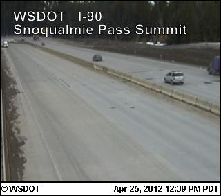
Washington State Dept.
of Transportation: Traffic Cam Map
|
|
(52 Miles
from Seattle)

Webcam: The Summit at
Snoqualmie
(52 Miles
from Seattle)

Webcam: The Summit at
Snoqualmie
|
|
Snoqualmie Pass -
East Side
(55 Miles
from Seattle)
Washington
State Dept. of Transportation: Traffic
Cam Map
|
East Cascades - Price Creek
(61 Miles
from Seattle)
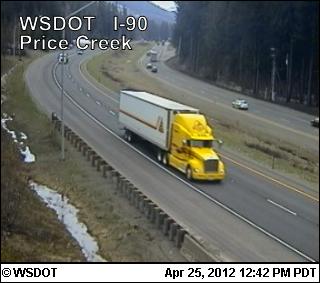 Washington State Dept.
of Transportation: Traffic Cam Map
Washington State Dept.
of Transportation: Traffic Cam Map
|
|
East Cascades -
Easton Hill
(67 Miles
from Seattle)
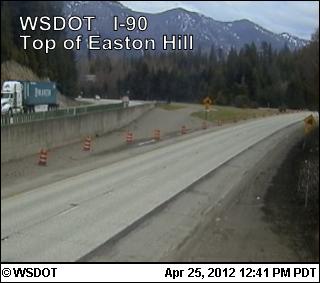 Washington State Dept.
of Transportation: Traffic Cam Map
Washington State Dept.
of Transportation: Traffic Cam Map
East Cascades -
Easton
(70 Miles
from Seattle)
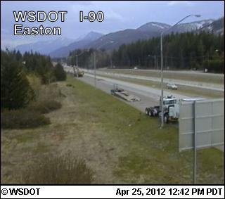 Washington State Dept.
of Transportation: Traffic Cam Map
Washington State Dept.
of Transportation: Traffic Cam Map
East Cascades -
Elk Heights/Cle Elum Area
(Approx. 93 Miles
from Seattle)
 Washington State Dept.
of Transportation: Traffic Cam Map
Washington State Dept.
of Transportation: Traffic Cam Map
Manastash Ridge Summit
(117 Miles
from Seattle on I-82 @ MP 7)
 Washington State Dept.
of Transportation: Traffic Cam Map
Washington State Dept.
of Transportation: Traffic Cam Map
|
Northeast
of Seattle, Along U.S. 2
(Stevens Pass is 90 Miles from Seattle)
|
Stevens Pass - West
Summit
(90 Miles
from Seattle)
Washington State Dept.
of Transportation: Traffic Cam Map
|
Stevens Pass - East
Summit
(90 Miles
from Seattle)
 Washington State Dept.
of Transportation: Traffic Cam Map
Washington State Dept.
of Transportation: Traffic Cam Map
|
|
(90 Miles
from Seattle)

Webcam: StevenPass.com
|

Webcam: Leavenworth
Chamber of
Commerce - "Washington's
Bavarian Village"
|

Webcam from: River
Haus in the Pines Bed and Breakfast
|

|
|

Webcam: Mountain Home Lodge
Looking southwest across
their 20 acre meadow and into the Stuart
Mountain Range of the Cascades.
|
Wenatchee Area - Blewett
Pass
(112 Miles
from Seattle on U.S. 97 via I-90)
(151 Miles from Seattle on U.S. 97 via U.S. 2)
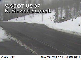 Washington State Dept.
of Transportation: Traffic Cam Map
Washington State Dept.
of Transportation: Traffic Cam Map
|
Northeast of Seattle
|

Webcam:
Mission Ridge Ski & Board Resort
|

Webcam: Campbell's Resort on
Lake Chelan
|
Northeast
of Seattle, Along WA 20 via I-5
|
|

Webcam: National Park
Service - North
Cascades National Park
|
Winthrop Area -
North Cascades
(198 Miles
from Seattle)
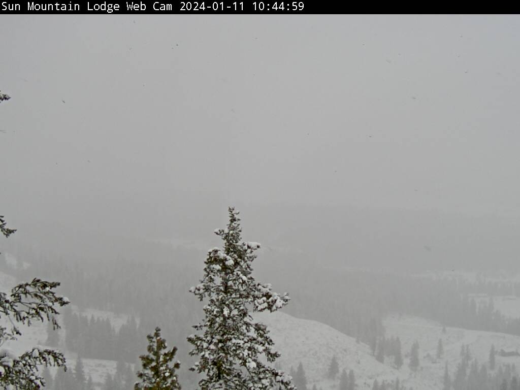
Webcam: Sun
Mountain Lodge, Winthrop, WA,
North Cascades
|
|
|
North
and West of
Seattle
The San Juan Islands - Via I-5/U.S.20/Ferry
|
Anacortes Ferry

Washington State Dept.
of Transportation: Traffic Cam Map
...Another
view of Takeoff Point to The San Juan Islands...

San Juan Islands
Webcams: IslandCam.com,
Kenmore Air Harbor
|
|

San
Juan Islands Webcams: IslandCam.com, Kenmore Air Harbor
|
|

San Juan Islands
Webcams: IslandCam.com,
Kenmore Air Harbor |

San Juan Islands
Webcams: IslandCam.com,
Kenmore Air Harbor
|
|

San Juan Islands
Webcams: IslandCam.com,
Kenmore Air Harbor
|

San Juan Islands
Webcams: IslandCam.com,
Kenmore Air Harbor
|
(Looking at The Straits of
Juan de Fuca)

San Juan Islands
Webcams: IslandCam.com,
Kenmore Air Harbor
|
|
(Looking at West View of
Victoria Harbor)

San Juan Islands
Webcams: IslandCam.com,
Kenmore Air Harbor
|
|
South and East of Seattle
|
|

Webcam:
National Park Service - Mount
Rainier National Park
|
|
|

Webcam looking at Gold
Hills: Crystal Mountain
- Washington's Largest Ski Area
|

Washington State Dept.
of Transportation: Traffic Cam Map
|
South of Seattle
|
|
Washington State Dept.
of Transportation: Traffic Cam Map
Washington State Dept.
of Transportation: Traffic Cam Map

Webcam: USDA
Forest Service
- Mt. Baker-Snoqualmie National Forest
|
Southeast Cascades -
Satus Pass
(197 Miles from Seattle)

Washington State Dept.
of Transportation: Traffic Cam Map
|
Heading West from Seattle to the Olympic
Peninsula
Via:
Seattle-Bainbridge Island Ferry (except image immediately below is
Bremerton Ferry)
|
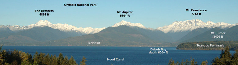
 The webcam is
pointed west,
looking across Hood Canal, an arm of Puget Sound, towards the Olympic
Mountains.
The webcam is
pointed west,
looking across Hood Canal, an arm of Puget Sound, towards the Olympic
Mountains.
Incredible
Webcam from Dale Ireland's
website: DrDale.com
(Below is the index of what you're seeing
on a clear day)
 Washington State Dept.
of Transportation: Traffic Cam Map
Washington State Dept.
of Transportation: Traffic Cam Map
|

Washington State Dept.
of Transportation: Traffic Cam Map

Webcam: Jefferson County
|

Webcam: Jesse at Nikola,
Sequim.com
and MySequim.com

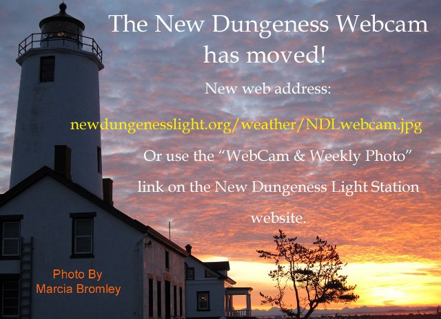
Webcam: New Dungeness Lighthouse.org

Webcam: PortOfPA.com
(85
Miles from Seattle: 77 Miles Driving & 8 Miles via Ferry)

Webcam: Port Angeles Inn
|
(105
Miles from Seattle: 97 Miles Driving & 8 Miles via Ferry)

Webcam: National
Park Service - Olympic National Park
|

Due to weather
conditions on Hurricane Ridge, this live cam is occasionally offline
Webcam: National
Park Service - Olympic National Park
|
|
|

Webcam: Quillayute
River Resort,
Forks Area
|
|

Webcam: Forks Chamber of Commerce
|
|

Webcam: Westport Seascape
Productions
|
|

Webcam: The
Breakers of Long Beach, Washington
This
Live Cam has been having occasional problems lately
|
|

Webcam: Pacific
Reality
Clam Cam
|
Heading South of Seattle to the Washington
- Oregon State Border
|
|

Webcam: Sawtooth Technologies
|
USDA - Forest Services
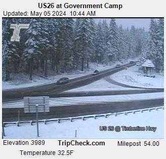
Oregon Dept.
of Transportation: TripCheck Traffic
Cam Map

USDA - Forest Services
- Mount
Hood
|

Return to the Main
Page
|